Hi,您当前浏览器版本过低,可能会影响浏览效果,建议下载使用感更好的浏览器,或者使用360浏览器极速模式浏览!
We speak with Jonathan Deacon, Product Manager of OxTS, to learn more about how their technology works and how they are expanding into new industries.
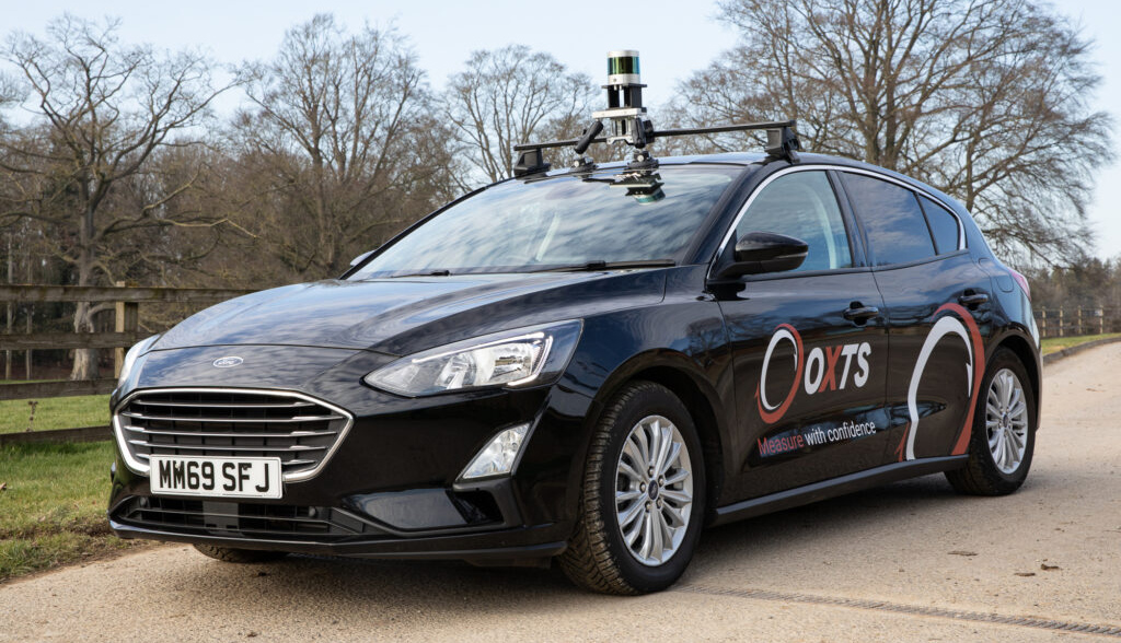
One example of this is that we are enabling our customers to confidently move ADAS testing from proving grounds to the open road, using data from other sensor technology, to overcome the challenges associated with GNSS signal disruption. This can happen in places like urban canyons, where the street is flanked by buildings on both sides, creating a canyon-like environment. As noted, we are also extending these solutions to our mapping customers to further boost point cloud accuracy.
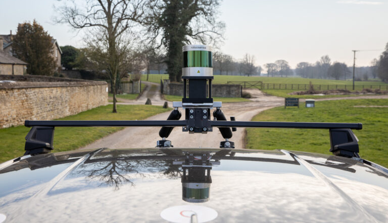
Jonathan Deacon: OxTS leverages the RoboSense Ruby Plus, Helios, Bpearl and M Platform sensors in two distinct software solutions:
1. Earlier, I mentioned our GAD interface. One of the first features of our GAD is the OxTS LiDAR Inertial Odometry (LIO) software, which can be added to any OxTS device. LIO uses raw data from RoboSense lidar sensors to provide the INS navigation engine with a velocity update. This helps constrain position drift and minimize initial measurement unit (IMU) errors, which occur in the absence of GNSS and becomes more pronounced the longer GNSS is unavailable. By constraining position drift, users of OxTS LIO will benefit from better navigation data and more accurate point clouds in GNSS-denied environments. With this solution, ADAS test engineers can trust their vehicle position, enabling confident testing of new ADAS features exactly where they will be used – out on the open road.
2. OxTS Georeferencer is a software suite that offers two key benefits: Firstly, the Boresight Calibration Tool aligns the coordinate frames between a RoboSense lidar sensor and your INS. This alignment enhances perception accuracy in relation to an autonomous or survey vehicle. It will also eliminate blurring and double vision from any subsequent point clouds you create.
The second key benefit of OxTS Georeferencer is its ability to enable quick and simple georeferencing of RoboSense lidar data to create a precise point cloud using both OxTS and third-party INS devices. In the past, users would have to engineer their own software to georeference lidar data, adding additional complexity and time to a project. Now, they have a straightforward solution.
Q: Why did you choose RoboSense’s sensors for your solutions
Jonathan Deacon: RoboSense's lidar sensors were a natural choice to integrate with OxTS technology. RoboSense is a leader in its field and is particularly well known in the ADAS and autonomy industries. RoboSense’s sensors are easily paired with OxTS products, ensuring accuracy while saving time and effort, which customers have come to expect from OxTS when building their solutions.
As a leading provider of navigation solutions to these industries ourselves, it made sense to work more closely with RoboSense to ensure our mutual customers benefit from our shared expertise. OxTS and RoboSense represent the perfect dovetailing of technological capability.
Q. What’s next for your company?
Want to know more about RoboSense’s products? Fill out our contact form.
 Building 9, Block 2, Zhongguan Honghualing Industry Southern District, 1213 Liuxian Avenue, Taoyuan Street, Nanshan District, Shenzhen, China
 service@robosense.cn
 0755-8632583046057 Five Mile Rd., Plymouth, MI 48170800 West El Camino Real, Suite 180, Mountain View, California 94040rsi-office@robosense.aiWhistleblower Email:voice@robosense.ai